 Catálogo de Datos Abiertos Geoespaciales
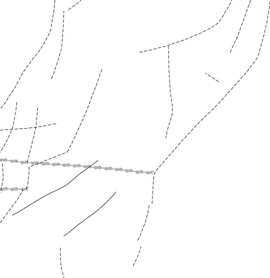
SH21 Corrientes Fallas 1M
Simple
- Date (Publication)
- 2021-09-29T12:22:14
- Status
- Completed
+54 11 5670-0100
https://sigam.segemar.gov.ar
- Maintenance and update frequency
- As needed
- Theme
-
- SEGEMAR
- SIGAM
- Geología
- Medio Ambiente
- Recursos Naturales
- e1M.SH21.Fallas
- Access constraints
- Other restrictions
- Other constraints
-
La información y los datos producidos por el SEGEMAR, y publicados en SIGAM, están disponibles bajo la Licencia Creative Commons Atribución 4.0 Internacional (CC BY 4.0). https://creativecommons.org/licenses/by/4.0/deed.es
Se permite su uso, copia, modificación y redistribución (incluidos productos derivados), siempre que se reconozca debidamente la autoría institucional y se cite la fuente original.
- Spatial representation type
- Vector
- Denominator
- 1000000
- Topic category
-
- Geoscientific information
))
- Reference system identifier
- CRS:84
- Reference system identifier
- EPSG:4326
- Distribution format
-
-
(
)
-
(
)
- OnLine resource
-
sigam:e1M.SH21.Fallas
(
OGC:WMS
)
SH21 Corrientes Fallas 1M
- OnLine resource
-
sigam:e1M.SH21.Fallas
(
WWW:LINK-1.0-http--link
)
SH21 Corrientes Fallas 1M
(WFS). El conjunto de datos está publicado en el servicio de descarga (WFS) disponible en
- OnLine resource
-
sigam:e1M.SH21.Fallas
(
WWW:DOWNLOAD-1.0-http--download
)
SH21 Corrientes Fallas 1M
(SHAPE-ZIP)
- OnLine resource
-
sigam:e1M.SH21.Fallas
(
WWW:DOWNLOAD-1.0-http--download
)
SH21 Corrientes Fallas 1M
(GEOJSON)
- OnLine resource
-
sigam:e1M.SH21.Fallas
(
WWW:DOWNLOAD-1.0-http--download
)
SH21 Corrientes Fallas 1M
(CSV)
- OnLine resource
-
sigam:e1M.SH21.Fallas
(
WWW:DOWNLOAD-1.0-http--download
)
SH21 Corrientes Fallas 1M
(KML)
- Hierarchy level
- Dataset
- Statement
- Fuente: Comisión para el Mapa Geológico del Mundo (CGMW) y Asociación de Servicios Geológicos y Mineiros Iberoamericanos (ASGMI), 2009. Mapa Geológico y de Recursos Minerales de América del Sur (SIG - América del Sur, 1:1 M), Hoja SH21 Concordia (Ar); Uruguayana (Br); Arapey (Ur). 1 mapa. Buenos Aires, Servicio Geológico Minero Argentino, Servicio Geológico de Brasil. Compañía de Pesquisa de Recursos Minerales y Dirección Nacional de Minería y Geología (Uruguay). https://repositorio.segemar.gov.ar/handle/308849217/2877
- File identifier
- 829f4bdf4d91ee102c1b695a2b36454fc84ce0d2 XML
- Metadata language
- Spanish; Castilian
- Character set
- UTF8
- Hierarchy level
- Dataset
- Date stamp
- 2026-05-15T15:47:41
- Metadata standard name
- ISO 19115:2003/19139
- Metadata standard version
- 1.0
+54 11 5670-0100
https://sigam.segemar.gov.ar
Overviews
Spatial extent
Provided by